

Analysis of the consumption curve of the channel and flood flows
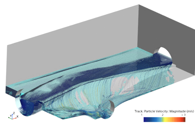
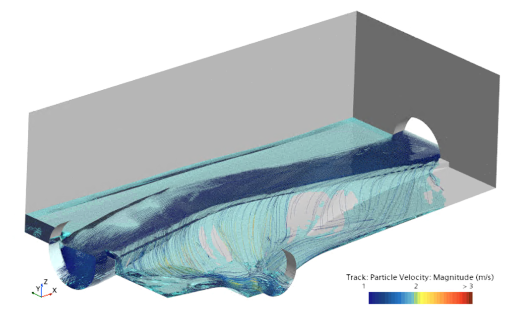
The goal of the project was to create a detailed 3D CFD model of real riverbeds based on LiDAR scanning and subsequently develop consumption curves for real-time flow measurement. The geometry of the riverbed was created using a green laser, which penetrates below the water surface and captures the bottom in greater detail compared to standard laser scanning stations. This point cloud was then converted into a surface and a 3D domain for CFD simulation was created.
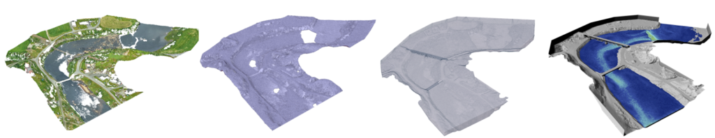
From left: point cloud – surface mesh – volume domain – CFD simulation.
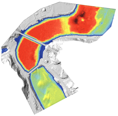
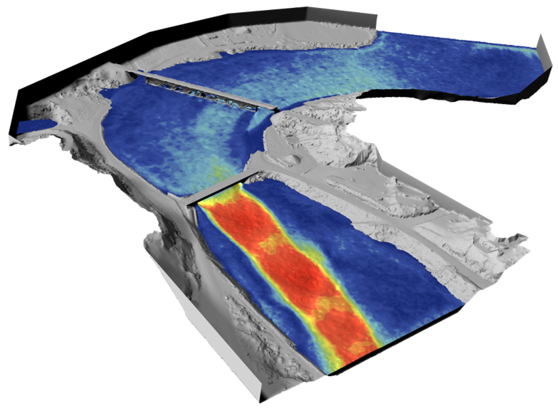
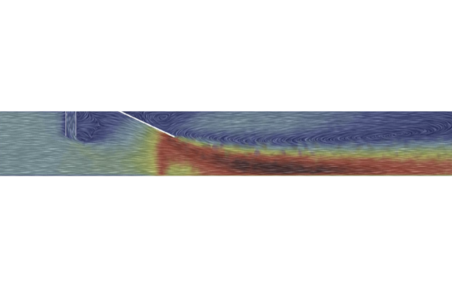
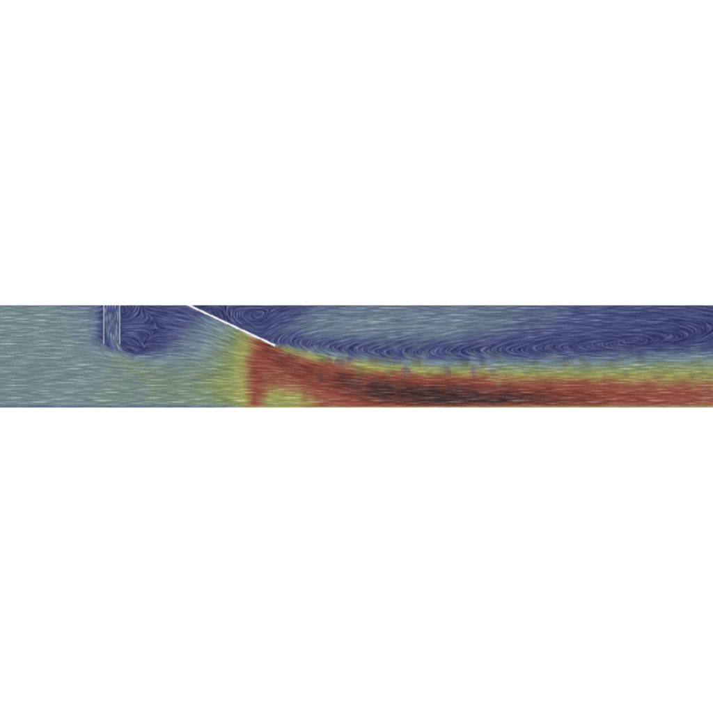
Thanks to the CFD mathematical model, it is possible to simulate not only regular flows but, more importantly, large flood events. This allows for monitoring both flooded areas and, for instance, the impact of bridge structures and flow when the water level reaches the bridge deck, potentially compromising the stability of the entire structure.
By simulating a range of flow conditions, a consumption curve can be generated, which can then be easily used for real-time flow measurements. This allows for pairing the on-site measured water level with the curve from the model, providing an accurate current flow value in the channel, regardless of its shape, with great precision.
One of the high flow conditions that have never been physically recorded
Related items
Design of the artificial slalom course in Kadaň.
Pipe mixer
Hydraulic Optimization of a settling tank at wastewater treatment plant in Prague